Fry, Seine-Maritime
Fry (French pronunciation: [fʁi]) is a commune in the Seine-Maritime department in the Normandy region in northern France.
Fry | |
|---|---|
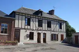 The town hall in Fry | |
Location of Fry | |
 Fry  Fry | |
| Coordinates: 49°31′50″N 1°31′40″E | |
| Country | France |
| Region | Normandy |
| Department | Seine-Maritime |
| Arrondissement | Dieppe |
| Canton | Gournay-en-Bray |
| Intercommunality | CC 4 rivières |
| Government | |
| • Mayor (2020–2026) | Sylvie Aché[1] |
| Area 1 | 8.03 km2 (3.10 sq mi) |
| Population | 142 |
| • Density | 18/km2 (46/sq mi) |
| Time zone | UTC+01:00 (CET) |
| • Summer (DST) | UTC+02:00 (CEST) |
| INSEE/Postal code | 76292 /76780 |
| Elevation | 108–216 m (354–709 ft) (avg. 118 m or 387 ft) |
| 1 French Land Register data, which excludes lakes, ponds, glaciers > 1 km2 (0.386 sq mi or 247 acres) and river estuaries. | |
Geography
A small farming village situated in the Pays de Bray, some 20 miles (32 km) northeast of Rouen, at the junction of the D1, D128 and the D921 roads.
Population
| Year | Pop. | ±% p.a. |
|---|---|---|
| 1968 | 167 | — |
| 1975 | 150 | −1.52% |
| 1982 | 123 | −2.80% |
| 1990 | 133 | +0.98% |
| 1999 | 136 | +0.25% |
| 2007 | 137 | +0.09% |
| 2012 | 161 | +3.28% |
| 2017 | 148 | −1.67% |
| Source: INSEE[3] | ||
Places of interest
- The thirteenth century church of St.Martin.
- A presbytery dating from the seventeenth century.
References
- "Répertoire national des élus: les maires" (in French). data.gouv.fr, Plateforme ouverte des données publiques françaises. 13 September 2022.
- "Populations légales 2020". The National Institute of Statistics and Economic Studies. 29 December 2022.
- Population en historique depuis 1968, INSEE
External links
Wikimedia Commons has media related to Fry (Seine-Maritime).
- Fry on the Quid website (in French)
This article is issued from Wikipedia. The text is licensed under Creative Commons - Attribution - Sharealike. Additional terms may apply for the media files.