Morienne
Morienne is a commune in the Seine-Maritime department in the Normandy region in northern France.
Morienne | |
|---|---|
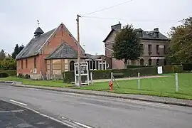 The church and town hall in Morienne | |
Location of Morienne | |
 Morienne  Morienne | |
| Coordinates: 49°46′58″N 1°42′38″E | |
| Country | France |
| Region | Normandy |
| Department | Seine-Maritime |
| Arrondissement | Dieppe |
| Canton | Gournay-en-Bray |
| Intercommunality | CC Aumale - Blangy-sur-Bresle |
| Government | |
| • Mayor (2020–2026) | Jean-Claude Becquet[1] |
| Area 1 | 8.91 km2 (3.44 sq mi) |
| Population | 189 |
| • Density | 21/km2 (55/sq mi) |
| Time zone | UTC+01:00 (CET) |
| • Summer (DST) | UTC+02:00 (CEST) |
| INSEE/Postal code | 76606 /76390 |
| Elevation | 105–214 m (344–702 ft) (avg. 200 m or 660 ft) |
| 1 French Land Register data, which excludes lakes, ponds, glaciers > 1 km2 (0.386 sq mi or 247 acres) and river estuaries. | |
Geography
A small farming village situated in the valley of the river Bresle in the Pays de Bray, some 47 kilometres (29 mi) southeast of Dieppe at the junction of the D502 and the D920 roads. The A29 autoroute passes through the territory of the commune.
Population
| Year | Pop. | ±% p.a. |
|---|---|---|
| 1968 | 225 | — |
| 1975 | 233 | +0.50% |
| 1982 | 180 | −3.62% |
| 1990 | 190 | +0.68% |
| 1999 | 178 | −0.72% |
| 2007 | 173 | −0.36% |
| 2012 | 173 | +0.00% |
| 2017 | 179 | +0.68% |
| Source: INSEE[3] | ||
Places of interest
- The church of St.Clothilde, dating from the eighteenth century.
- Traces of a 12th-century abbey.
References
- "Répertoire national des élus: les maires". data.gouv.fr, Plateforme ouverte des données publiques françaises (in French). 2 December 2020.
- "Populations légales 2020". The National Institute of Statistics and Economic Studies. 29 December 2022.
- Population en historique depuis 1968, INSEE
Wikimedia Commons has media related to Morienne.
This article is issued from Wikipedia. The text is licensed under Creative Commons - Attribution - Sharealike. Additional terms may apply for the media files.