La Vaupalière
La Vaupalière (French pronunciation: [la vopaljɛʁ]) is a commune in the Seine-Maritime department in the Normandy region in northern France.
La Vaupalière | |
|---|---|
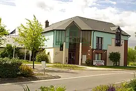 The town hall in La Vaupalière | |
 Coat of arms | |
Location of La Vaupalière | |
 La Vaupalière  La Vaupalière | |
| Coordinates: 49°29′19″N 0°59′45″E | |
| Country | France |
| Region | Normandy |
| Department | Seine-Maritime |
| Arrondissement | Rouen |
| Canton | Notre-Dame-de-Bondeville |
| Government | |
| • Mayor (2020–2026) | Bernard Brunet[1] |
| Area 1 | 8.0 km2 (3.1 sq mi) |
| Population | 1,171 |
| • Density | 150/km2 (380/sq mi) |
| Time zone | UTC+01:00 (CET) |
| • Summer (DST) | UTC+02:00 (CEST) |
| INSEE/Postal code | 76728 /76150 |
| Elevation | 50–138 m (164–453 ft) (avg. 120 m or 390 ft) |
| 1 French Land Register data, which excludes lakes, ponds, glaciers > 1 km2 (0.386 sq mi or 247 acres) and river estuaries. | |
Geography
A village of forestry, farming and a little light industry, situated some 6 miles (9.7 km) northwest of Rouen, at the junction of the D267, D43 and the D94 roads. The A151 autoroute passes through the commune's south-eastern section.
Population
| Year | Pop. | ±% p.a. |
|---|---|---|
| 1968 | 555 | — |
| 1975 | 668 | +2.68% |
| 1982 | 845 | +3.41% |
| 1990 | 902 | +0.82% |
| 1999 | 1,026 | +1.44% |
| 2007 | 992 | −0.42% |
| 2012 | 960 | −0.65% |
| 2017 | 1,057 | +1.94% |
| Source: INSEE[3] | ||
Places of interest
- The church of St. Léonard, dating from the sixteenth century.
- A manor house called the chateau of Parquet, from the seventeenth century.
References
- Liste des maires du département de la Seine-Maritime, 10 August 2020
- "Populations légales 2020". The National Institute of Statistics and Economic Studies. 29 December 2022.
- Population en historique depuis 1968, INSEE
Wikimedia Commons has media related to La Vaupalière.
This article is issued from Wikipedia. The text is licensed under Creative Commons - Attribution - Sharealike. Additional terms may apply for the media files.