Ceton
Ceton (French pronunciation: [sətɔ̃] ⓘ) is a commune in the Orne department in north-western France. It is the southernmost municipality in Normandy. The commune has the largest surface area of the communes based in the Orne, at 59.39 km ²[3]
Ceton | |
|---|---|
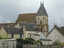 The church in Ceton | |
.svg.png.webp) Coat of arms | |
Location of Ceton | |
 Ceton  Ceton | |
| Coordinates: 48°13′37″N 0°45′03″E | |
| Country | France |
| Region | Normandy |
| Department | Orne |
| Arrondissement | Mortagne-au-Perche |
| Canton | Ceton |
| Intercommunality | Collines du Perche Normand |
| Government | |
| • Mayor (2020–2026) | Patrick Grégori[1] |
| Area 1 | 59.39 km2 (22.93 sq mi) |
| Population | 1,768 |
| • Density | 30/km2 (77/sq mi) |
| Time zone | UTC+01:00 (CET) |
| • Summer (DST) | UTC+02:00 (CEST) |
| INSEE/Postal code | 61079 /61260 |
| Elevation | 89–271 m (292–889 ft) (avg. 130 m or 430 ft) |
| 1 French Land Register data, which excludes lakes, ponds, glaciers > 1 km2 (0.386 sq mi or 247 acres) and river estuaries. | |
Heraldry
Arms of Ceton |
The arms of Ceton are blazoned : Azure, a bend Or, and in chief a fleur de lys argent.
|
See also
References
- "Répertoire national des élus: les maires" (in French). data.gouv.fr, Plateforme ouverte des données publiques françaises. 13 September 2022.
- "Populations légales 2020". The National Institute of Statistics and Economic Studies. 29 December 2022.
- "ORNE : map, cities and data of the departement of Orne 61". www.map-france.com.
- "24 jumelages franco-allemands dans l'Orne". Ouest-France.fr. 21 January 2013.
Wikimedia Commons has media related to Ceton.
This article is issued from Wikipedia. The text is licensed under Creative Commons - Attribution - Sharealike. Additional terms may apply for the media files.