Saint-Clair-de-Halouze
Saint-Clair-de-Halouze (French pronunciation: [sɛ̃ klɛʁ də aluz] ⓘ) is a commune in the Orne department in north-western France.[3] It is situated midway between Domfront and Flers. It was originally a centre for ferrous mining and the little community, the minehead and the railway line, now a path, remain. The small river Halouze flows through the village on its way to join the Varenne (Loire basin).
Saint-Clair-de-Halouze | |
|---|---|
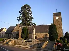 The church in Saint-Clair-de-Halouze | |
Location of Saint-Clair-de-Halouze | |
 Saint-Clair-de-Halouze  Saint-Clair-de-Halouze | |
| Coordinates: 48°40′48″N 0°37′26″W | |
| Country | France |
| Region | Normandy |
| Department | Orne |
| Arrondissement | Argentan |
| Canton | Flers-1 |
| Intercommunality | CA Flers Agglo |
| Government | |
| • Mayor (2020–2026) | Jean-Luc Champin[1] |
| Area 1 | 11.81 km2 (4.56 sq mi) |
| Population | 849 |
| • Density | 72/km2 (190/sq mi) |
| Time zone | UTC+01:00 (CET) |
| • Summer (DST) | UTC+02:00 (CEST) |
| INSEE/Postal code | 61376 /61490 |
| Elevation | 187–306 m (614–1,004 ft) (avg. 223 m or 732 ft) |
| 1 French Land Register data, which excludes lakes, ponds, glaciers > 1 km2 (0.386 sq mi or 247 acres) and river estuaries. | |
See also
References
- "Répertoire national des élus: les maires". data.gouv.fr, Plateforme ouverte des données publiques françaises (in French). 9 August 2021.
- "Populations légales 2020". The National Institute of Statistics and Economic Studies. 29 December 2022.
- INSEE commune file
Wikimedia Commons has media related to Saint-Clair-de-Halouze.
This article is issued from Wikipedia. The text is licensed under Creative Commons - Attribution - Sharealike. Additional terms may apply for the media files.