Durcet
Durcet (French pronunciation: [dyʁsɛ] ⓘ) is a commune in the Orne department in north-western France.
Durcet | |
|---|---|
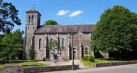 The church in Durcet | |
Location of Durcet | |
 Durcet  Durcet | |
| Coordinates: 48°44′52″N 0°26′05″W | |
| Country | France |
| Region | Normandy |
| Department | Orne |
| Arrondissement | Argentan |
| Canton | Athis-Val de Rouvre |
| Intercommunality | CA Flers Agglo |
| Government | |
| • Mayor (2020–2026) | Gérard Pierre[1] |
| Area 1 | 9.54 km2 (3.68 sq mi) |
| Population | 292 |
| • Density | 31/km2 (79/sq mi) |
| Time zone | UTC+01:00 (CET) |
| • Summer (DST) | UTC+02:00 (CEST) |
| INSEE/Postal code | 61148 /61100 |
| Elevation | 198–275 m (650–902 ft) (avg. 243 m or 797 ft) |
| 1 French Land Register data, which excludes lakes, ponds, glaciers > 1 km2 (0.386 sq mi or 247 acres) and river estuaries. | |
Geography
The commune is part of the area known as Suisse Normande.[3]
The commune is made up of the following collection of villages and hamlets, Le Val,Le Baux, La Grande Ferme, La Maurinais,Le Mesnil Logis,Magny and Durcet.[4]
The commune has 7 watercourses running through it the river Gine and 5 streams the Prevostiere, the Grand Ros, the Meheudin, the Loget, the Ferronniere and the Onfrairies.[5]
Neighbouring communes[4] | |
|---|---|
See also
References
- "Répertoire national des élus: les maires". data.gouv.fr, Plateforme ouverte des données publiques françaises (in French). 2 December 2020.
- "Populations légales 2020". The National Institute of Statistics and Economic Studies. 29 December 2022.
- "Map of Suiss Normande" (PDF).
- "Durcet · 61100, France". Durcet · 61100, France.
- "Mairie de Durcet et sa commune (61100)". Annuaire-Mairie. 27 April 2023.
Wikimedia Commons has media related to Durcet.
This article is issued from Wikipedia. The text is licensed under Creative Commons - Attribution - Sharealike. Additional terms may apply for the media files.