La Lande-Saint-Siméon
La Lande-Saint-Siméon (French pronunciation: [la lɑ̃d sɛ̃ simeɔ̃] ⓘ) is a commune in the Orne department in north-western France.
La Lande-Saint-Siméon | |
|---|---|
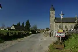 The church in La Lande-Saint-Siméon | |
Location of La Lande-Saint-Siméon | |
 La Lande-Saint-Siméon  La Lande-Saint-Siméon | |
| Coordinates: 48°49′23″N 0°26′05″W | |
| Country | France |
| Region | Normandy |
| Department | Orne |
| Arrondissement | Argentan |
| Canton | Athis-Val de Rouvre |
| Intercommunality | CA Flers Agglo |
| Government | |
| • Mayor (2020–2026) | Didier Delaporte[1] |
| Area 1 | 5.33 km2 (2.06 sq mi) |
| Population | 159 |
| • Density | 30/km2 (77/sq mi) |
| Time zone | UTC+01:00 (CET) |
| • Summer (DST) | UTC+02:00 (CEST) |
| INSEE/Postal code | 61219 /61100 |
| Elevation | 104–227 m (341–745 ft) (avg. 120 m or 390 ft) |
| 1 French Land Register data, which excludes lakes, ponds, glaciers > 1 km2 (0.386 sq mi or 247 acres) and river estuaries. | |
Geography
The commune is part of the area known as Suisse Normande.[3]
The commune is made up of the following collection of villages and hamlets, Les Bourbes,Le Mâly, La Croûte, Lorièe de Bas and La Lande-Saint-Siméon.[4]
Neighbouring communes[4] | ||||||||||||||||
|---|---|---|---|---|---|---|---|---|---|---|---|---|---|---|---|---|
| ||||||||||||||||
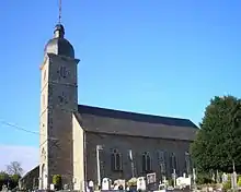
La Lande-Saint-Simeon church
See also
References
- "Répertoire national des élus: les maires". data.gouv.fr, Plateforme ouverte des données publiques françaises (in French). 9 August 2021.
- "Populations légales 2020". The National Institute of Statistics and Economic Studies. 29 December 2022.
- "Map of Suiss Normande" (PDF).
- "Google Maps". Google Maps.
Wikimedia Commons has media related to La Lande-Saint-Siméon.
This article is issued from Wikipedia. The text is licensed under Creative Commons - Attribution - Sharealike. Additional terms may apply for the media files.