Gujrat District
Gujrat (Punjabi, Urdu: ضلع گجرات) is a district in the Pakistani province of Punjab. It is geographically located between the Chenab and Jhelum rivers and headquartered at the city of Gujrat.
Gujrat
ضلع گجرات | |
|---|---|
   | |
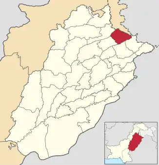 Map of Gujrat District in Punjab | |
| Country | |
| Province | |
| Division | Gujrat |
| Headquarters | Gujrat |
| Government | |
| • Type | District Administration |
| • Deputy Commissioner | Khurram Shahzad [1] |
| • District Police Officer | Umar Salamat |
| • District Health Officer | N/A |
| Area | |
| • Total | 3,192 km2 (1,232 sq mi) |
| Population (2017)[2] | |
| • Total | 2,756,110 |
| • Density | 860/km2 (2,200/sq mi) |
| Time zone | UTC+5 (PST) |
| Main language(s) | |
| Number of Tehsils | 4 |
| Website | https://gujrat.punjab.gov.pk/ |
It is bounded on the northeast by Mirpur, on the northwest by the River Jhelum, which separates it from Jhelum District, on the east and southeast by the Chenab River, separating it from the districts of Gujranwala and Sialkot, and on the west by Mandi Bahauddin. Gujrat is spread over an area of 3,192 square kilometres.
History
Ancient history
According to the British Imperial Gazetteer:
Gujrat town itself is a place of some antiquity, and the district bounds in ancient sites.The region was conquered by Chandragupta Maurya. It remained under the Mauryas for a few hundred years until shortly after the death of Ashoka in 231, and about forty years later came under the sway of Demetrius the Graeco-Bactrian. The overthrow of the Bactrians by the Parthians in the latter half of the second century brought another change of rulers, and the coins of the Indo-Parthian Maues (c. 120 B. c.), who is known to local tradition as Raja Moga, have been found at Mong. At the end of the first century A. D., i.e. the whole of the Punjab was conquered by the Yueh-chi. For several hundred years nothing is known of the history of the District, except that between 455 and 540 it must have been exposed to the ravages of the White Huns. Dr. Stein holds that the District formed part of the kingdom of Gurjara(Gurjar), which, according to the Rajatarangini, was invaded between 883 and 902 by Shankara Varman of Kashmir, who defeated its king Alakana.[3]
However the foundation of the capital, Gujrat, according to the Ancient Geography of India:
is ascribed to a king named Bachan Pal of whom nothing more is known; and its restoration is attributed to Alakhana, the Maha Raja of Gurjara, who was defeated by Sangkara Varmma between AD 883 and AD 901.[4]
Islamic Rule (Ghaznavid, Ghurid, Delhi, Suri, and Mughal Empires)
In 997 CE, Mahmud Ghaznavi, took rule over the Ghaznavid dynasty established by his father Sebuktegin. After defeating the Hindu Shahis, he conquered their kingdom entirely which included the Punjab region of modern day Pakistan.
After defeating the Ghaznavids, the Ghurids took over the region. They were in turn succeeded by the Sultanates of Delhi.
The Mughal emperor Akbar established Gujrat as a district along with many others when he began consolidating his rule over his vast empire. Jahangir, Akbar's son and successor, in his memoirs records the following information on Gujrat:
At the time when His Majesty Akbar went to Kashmir, a fort had been built on the bank of that river. Having brought to this fort a body of Gujars who had passed their time in the neighbourhood in thieving and highway robbery, he established them here. As it had become the abode of Gujars, he made it a separate pargana, and gave it the name of Gujrat. "[5]
Revenue records have been preserved in the families of the hereditary registrars (kanungos), and these exhibit Gujrat as the capital of a district containing 2,592 villages, paying a revenue of 11.6 million. In 1605, the famous Sayyid Abdul Kasim received Gujrat as a fief from Akbar.
In 1707, with Aurangzeb's death, the decline of Mughal power began in the Punjab region. Nadir Shah occupied the Punjab including Gujrat during his invasion of the Mughal Empire in 1739. The area was captured by Punjabi Gakhar tribesmen from near the Rawalpindi area after the invasion.
Gujrat and Punjab as a whole was devastated further from the invasions of the Durrani Afghans (Pashtuns) under Ahmad Shah Durrani between 1748 and 1767. Durrani took direct control over Punjab after Mir Mannu, the Mughal governor of Punjab, died in 1753. Durrani would frequently cross the area for plunder and to fight the newly emerged Sikh Misls.[3]
Sikh and British era
The Sikhs eventually took over most of northern Punjab after Ahmad Shah Durrani’s final invasion in 1767. The Sikhs under Gujjar Singh Bhangi took Gujrat after defeating the local Punjabi Ghakhars under Muqqarab Khan.
In 1798, the Bhangi leader Sahib Singh pledged allegiance to the Sukerchakia Misl of Ranjit Singh. By 1810, Ranjit Singh's armies captured the city from Bhangi forces, thereby extending the rule of the Sikh Empire to the city.
The Sikh empire declined following Ranjit Singh’s death in 1839. The British East India Company defeated the Sikhs between 1845 and 1846 during the First Anglo-Sikh War, reducing their power significantly. Two years later, the empire collapsed after the British EIC again decisively defeated the Sikhs at the Battle of Gujrat, thus ending the Second Anglo-Sikh War. The Sikh empire was entirely annexed and incorporated into the rule of the British EIC.[3]
Demographics
According to the 2017 census, the population of the district is 2,756,110, of which 1,334,775 are males and 1,421,295 are females. 1,928,789 live in rural areas while 827,500 live in urban areas.[2]
Religion
As per the 2017 census, Islam is the dominant religion with 99.08% of the population while there is a minority of 0.77% Christians who live mainly in urban areas.
| Religion | Population (1941)[6]: 42 | Percentage (1941) | Population (2017)[2] | Percentage (2017) |
|---|---|---|---|---|
| Islam |
945,609 | 85.58% | 2,730,946 | 99.08% |
| Hinduism |
84,643 | 7.66% | — | — |
| Sikhism |
70,233 | 6.36% | — | — |
| Christianity |
4,391 | 0.4% | 21,117 | 0.77% |
| Ahmadi | — | — | 4,4007 | 1.6% |
| Others [lower-alpha 3] | 76 | 0.01% | 219 | 0.01% |
| Total Population | 1,104,952 | 100% | 2,756,289 | 100% |
Language
According to the 2017 Pakistani census, 96.50% of the population spoke Punjabi and 1.81% Pashto as their first language.
Administration
The district is administratively subdivided into four tehsils, these are:
Education
District Gujrat has a total of 1,475 government schools at primary and secondary level.[8] Out of these public schools, 60 percent (889 schools) are for girls. According to the latest available data, 323,058 students are enrolled in the public schools while 10,581 teachers are working in these schools.
Notable people
Politicians
- Aitzaz Ahsan, Pakistani barrister
- Fazal Ilahi Chaudhry, President of Pakistan 1972–1977
- Chaudhry Pervaiz Elahi, former chief minister of Punjab and Federal Minister, Speaker of the Provincial Assembly of Punjab (from 16 August 2018 to present and from 1997 to June 2001).
Mian Tariq Mehmood (Urdu: میاں طارق محمود; born 5 May 1955, at Dinga, District Gujrat, is a Pakistani politician. He remained chairman, Town Committee Dinga, during 1987-92; as Member, Provincial Assembly of the Punjab during 1988-90, 1990-93 and 1997-99 and 2008-13 2013 to 2018; and also functioned as Parliamentary Secretary for Social Welfare & Zakat during 1988-90 and 1990-93; and as Minister for Population Welfare during 1993.
Chaudhry Zahoor Elahi, politician
- Moonis Elahi, Federal Minister for Water Resources [9] former MPA (2008-May2018) and Current MNA (Oct 2018 to present) of Gujrat
- Chaudhry Muhammed Farooq, former law minister
- Nawabzada Ghazanfar Ali Gul, former Federal Minister of Pakistan
- Mian Muhammad Afzal Hayat, former Chief Minister of Punjab and served as ambassador in different countries
- Shujaat Hussain, former 16th Prime Minister of Pakistan on a temporary basis (30 June 2004 to 28 August 2004)
- Chaudhry Jaffar Iqbal, Vice-President of PML-N Punjab
- Qamar Zaman Kaira, former Federal Minister of Pakistan
- Mian Imran Masood, former MPA of Gujrat and Minister of Education Punjab.
- Ahmad Mukhtar, Former Minister For Defence, Government of Pakistan
- Yasmin Qureshi, British MP
Scholars
- Ismat Beg, scientist
- Faisal Masud, medical doctor
Military
- Major Muhammad Akram, Nishan-e-Haider
- Major Raja Aziz Bhatti, Nishan-e-Haider
- Mohammad Shariff, Pakistan Navy Chief of Naval Staff and Chairman Joint Chiefs of Staff Committee
- General Raheel Sharif, is a four-star rank army general, served as the 15th Chief of Army Staff of the Pakistan Army
- Major Shabbir Sharif, Nishan-e-Haider
- ACM Zaheer Ahmad Babar, is a four-star rank Air Chief Marshal, serving AirChief of Pakistan. Pakistan Air Force.
Poets
- Orya Maqbool Jan, writer, columnist, analyst, former civil servant, and poet
- Shareef Kunjahi, Punjabi writer and poet
- Anwar Masood, poet
- Krishna Sobti, Hindi Writer
- Fakhar Zaman, writer and poet
Sport
- Tanwir Afzal, Hong Kong cricketer.
- Imtiaz Bhatti, Pakistani cyclist and a former Air Force pilot of Pakistan.
- Mudassar Bukhari. Dutch cricketer.
- Rizwan Cheema, Pakistani-Canadian cricketer.
- Munir Dar, Hong Kong cricketer.
Actors/Actresses
- Inayat Hussain Bhatti, film director and actor
- Ejaz Durrani, actor
- Shagufta Ejaz, actress
- Sabiha Khanum, actress
Musicians
- Adeel Chaudhry, also a dentist, actor, and model
- Alam Lohar, Punjabi folk singer
- Arif Lohar, Punjabi folk singer
- Zoe Viccaji, Pakistani singer-songwriter and musical actress
Other
- The family of UK-born Shafilea Ahmed, an honour killing victim, originated from Uttam.[10]
References
- "DCs of Gujrat, Rahim Yar Khan transferred". Dawn (newspaper). Retrieved 11 April 2023.
- "District And Tehsil Level Population Summary With Region Breakup" (PDF). Pakistan Bureau of Statistics, Government of Pakistan website. Archived from the original (PDF) on 23 November 2018. Retrieved 11 April 2023.
- Imperial Gazetteer of India, v. 12, p. 366
- The Ancient Geography of India, page 151, Alexander Cunningham
- The Memoirs of Jahangueir (Rogers), Volume 1, chpt. 23
- "CENSUS OF INDIA, 1941 VOLUME VI PUNJAB PROVINCE". Retrieved 21 July 2022.
- Ahmad, Salman. "Punjab to Get Two New Tehsils". ProPakistani.pk website. Retrieved 11 April 2023.
- "Punjab Annual Schools Census Data 2014-15". School Education Department, Government of the Punjab website. Archived from the original on 19 August 2016. Retrieved 11 April 2023.
- "PML-Q's Moonis Elahi sworn in as federal minister". Dawn.com. 20 July 2021. Retrieved 20 January 2022.
- Crilly, Rob (3 August 2012). "The Pakistan village where Shafilea drank bleach to avoid an arranged marriage". The Telegraph. Archived from the original on 12 January 2022. Retrieved 26 December 2019.
- Historic district borders may not be an exact match in the present-day due to various bifurcations to district borders — which since created new districts — throughout the historic Punjab Province region during the post-independence era that have taken into account population increases. This discrepancy can be seen in the district population history table which has taken into account the various bifurcations since 1941.
- 1941 census: Including Ad-Dharmis
- Including Jainism, Buddhism, Zoroastrianism, Judaism, or not stated
