Khanewal District
Khanewal District (Urdu and Punjabi: ضلع خانیوال Zilā khānēvāla) is a district of the Punjab province of Pakistan.[2] According to the 1998 census of Pakistan, the district had a population of 2,068,490, of which 17.42% were urban.[3] Khanewal is located at 30°18'0N 71°55'0E with an altitude of 128 metres.
Khanewal District
ضلع خانیوال | |
|---|---|
 .jpg.webp) | |
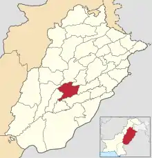 Location of Khanewal District (highlighted in orange) in Punjab | |
| Country | Pakistan |
| Province | Punjab |
| Division | Multan |
| Headquarters | Khanewal |
| Government | |
| • Type | District Administration |
| • District Police Officer | N/A |
| • District Health Officer | N/A |
| Area | |
| • Total | 4,349 km2 (1,679 sq mi) |
| Population (2017)[1] | |
| • Total | 2,920,233 |
| Time zone | UTC+5 (PST) |
| Number of Tehsilst|Tehsils | 4 |
| Website | khanewal |
Administrative divisions
For the purpose of administration, District Khanewal is divided into 4 tehsils i.e. Khanewal, Mian Channu, Jahanian and Kabirwala and 168 union councils including 114 rural and 54 urban whose elected representatives formulate Zilla and Tehsil councils. Political constituencies include 4 national seats and 7 provincial seats of legislative assemblies.[4][5] The district contains four tehsils which are as following:
Geography
Khanewal district is located at an average elevation of 150m above sea level with highest elevation of 252 metres at the town of Attari. This district is situated in the center of the country at an almost equal distance from Karachi and Peshawar and on the main routes of the railway and the Grand Trunk Road. It is also connected to Lahore Multan motorway. The district is bounded on the north by Jhang District and Toba Tek Singh District; on the south by Vehari District; on the east by Sahiwal District and on the west by Multan.[5]
Climate
| Climate data for Khanewal District[6] | |||||||||||||
|---|---|---|---|---|---|---|---|---|---|---|---|---|---|
| Month | Jan | Feb | Mar | Apr | May | Jun | Jul | Aug | Sep | Oct | Nov | Dec | Year |
| Record high °C (°F) | 28.3 (82.9) |
32.0 (89.6) |
39.0 (102.2) |
45.0 (113.0) |
46.9 (116.4) |
48.0 (118.4) |
48.2 (118.8) |
45.0 (113.0) |
42.5 (108.5) |
40.6 (105.1) |
36.0 (96.8) |
29.0 (84.2) |
48.2 (118.8) |
| Average high °C (°F) | 21.0 (69.8) |
23.2 (73.8) |
28.5 (83.3) |
35.5 (95.9) |
40.4 (104.7) |
42.3 (108.1) |
39.2 (102.6) |
38.0 (100.4) |
37.2 (99.0) |
34.6 (94.3) |
28.5 (83.3) |
22.7 (72.9) |
32.6 (90.7) |
| Daily mean °C (°F) | 12.7 (54.9) |
15.4 (59.7) |
21.0 (69.8) |
27.5 (81.5) |
32.4 (90.3) |
35.5 (95.9) |
33.9 (93.0) |
33.0 (91.4) |
31.0 (87.8) |
26.4 (79.5) |
19.7 (67.5) |
14.1 (57.4) |
25.2 (77.4) |
| Average low °C (°F) | 4.5 (40.1) |
7.6 (45.7) |
13.5 (56.3) |
19.5 (67.1) |
24.4 (75.9) |
28.6 (83.5) |
28.7 (83.7) |
28.0 (82.4) |
24.9 (76.8) |
18.2 (64.8) |
10.9 (51.6) |
5.5 (41.9) |
17.9 (64.1) |
| Record low °C (°F) | −2.2 (28.0) |
−1 (30) |
3.3 (37.9) |
9.4 (48.9) |
13.5 (56.3) |
20.0 (68.0) |
21.1 (70.0) |
21.1 (70.0) |
16.7 (62.1) |
8.9 (48.0) |
0.6 (33.1) |
−1.1 (30.0) |
−2.2 (28.0) |
| Average precipitation mm (inches) | 7.2 (0.28) |
9.5 (0.37) |
19.5 (0.77) |
12.9 (0.51) |
9.8 (0.39) |
12.3 (0.48) |
61.3 (2.41) |
32.6 (1.28) |
10.8 (0.43) |
1.7 (0.07) |
2.3 (0.09) |
6.9 (0.27) |
186.8 (7.35) |
| Mean monthly sunshine hours | 222.3 | 211.6 | 250.8 | 273.3 | 293.5 | 266.8 | 265.0 | 277.6 | 277.6 | 274.9 | 255.0 | 229.2 | 3,097.6 |
| Source: NOAA (1961–1990)[7] | |||||||||||||
Demographics
At the time of the 2017 census the District Khanewal had a population of 2,920,233, of which 1,482,668 were males and 1,437,272 females. Rural population is 2,333,801 while the urban population is 586,432. The literacy rate was 58.59%. Muslims were the predominant religious community with 98.26% of the population while Christians were 1.69% of the population.[1]
At the time of the 2017 census, 73.41% of the population spoke Punjabi, 18.55% Saraiki, 6.47% Urdu and 1.16% Pashto as their first language.[1]
According to the census of 1998, Punjabi is the most widely spoken first language,[8] accounting for 81% of the population. Urdu was the native language of 7.8% (although almost all of the inhabitants of the district use it as a second language),[9] Saraiki is native to 5.8% and Pashto – to 1.1%.[10]: 21–22
The main tribes and clans include:[9] Niazi Afghans, Seoul, Daduana, Kamboh, Matyana, Gujjar, Doltana, Sahu, Rajputs (Rana), Rajpoot Dhudhi, Awan, Sheikh, Jatt, Bucha, Nikyana Sial, Siyal, Arain, Bhati, Baloch, Khokhars Mayo Solgi (jutt) and toru.
Education
The education system in Khanewal district is formulated along specific modern, religious, cultural, social, psychological, commerce and scientific injunctions. The current literacy rate of district is 39.9%.[11] The standard national system of education is mainly inspired from the British system. The system also aims to imbibe a secular outlook among the students with the awareness of the rich cultural heritage of Pakistan. Khanewal district has a wide range of schools, colleges and universities that caters to diverse streams.
The system is divided into five levels: primary (grades one through five); middle (grades six through eight); high (grades nine and ten, leading to the Secondary School Certificate); intermediate (grades eleven and twelve, leading to a Higher Secondary School Certificate); and university programs leading to graduate and advanced degrees.
Khanewal district, like majority of the districts in Pakistan has both public and private educational institutions from primary to university level. Most educational institutions are gender based from primary to university level.
All academic education institutions are the responsibility of the provincial governments. The federal government mostly assists in curriculum development, accreditation and some financing of research.
Notable people
- Maulana Tariq Jameel, Islamic Scholar
- Syed Fakhar Imam, Ex. Speaker National Assembly of Pakistan
- Syed Hussain Jahania Gardeziis a Pakistani politician, who is currently serving as 'Provincial Minister of Punjab for Management and Professional Development
- Ghulam Haider Wyne, Ex. Chief Minister of Punjab
- Brig Muhammad Yaqoob Ilahi, Remount Veterinary and Farms Corps, Pakistan Army
- Tasawar Hayat, Pakistani scientist.
- Har Gobind Khorana, Indian American Nobel Prize winner for Medicine.
Villages
References
- "District Wise Results / Tables (Census - 2017)". www.pbscensus.gov.pk. Pakistan Bureau of Statistics.
- Khanewal | Punjab Portal. Retrieved 16 January 2022, from https://www.punjab.gov.pk/khanewal
- Population - Urban Resource Centre Archived 2006-05-13 at the Wayback Machine
- List of tehsils and districts - Statpak.gov Archived 30 December 2010 at the Wayback Machine
- District Health Profile - Khanewal. Citeseerx.ist.psu.edu. Retrieved 16 January 2022, from http://citeseerx.ist.psu.edu/viewdoc/download;jsessionid=68A7FAC41C5DC95DE087DD5DCC900BC6?doi=10.1.1.695.4631&rep=rep1&type=pdf.
- Climate | District Khanewal. Khanewal.punjab.gov.pk. (2022). Retrieved 16 January 2022, from https://khanewal.punjab.gov.pk/climate.
- "Khanewal Climate Normals 1961–1990". National Oceanic and Atmospheric Administration. Retrieved 16 January 2021.
- "Mother tongue": defined as the language of communication between parents and children.
- The People | District Khanewal. Retrieved from: https://khanewal.punjab.gov.pk/the-people
- 1998 District Census report of Khanewal. Census publication. Vol. 87. Islamabad: Population Census Organization, Statistics Division, Government of Pakistan. 2000.
- District at a glance Khanewal | Pakistan Bureau of Statistics. Pbs.gov.pk. (2022). Retrieved 15 January 2022, from https://www.pbs.gov.pk/content/district-glance-khanewal.
