Étupes
Étupes (French pronunciation: [etyp]) is a commune in the Doubs department in the Bourgogne-Franche-Comté region in eastern France.
Étupes | |
|---|---|
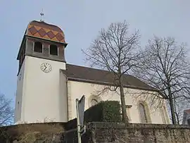 The church in Étupes | |
 Coat of arms | |
Location of Étupes | |
 Étupes  Étupes | |
| Coordinates: 47°30′25″N 6°51′43″E | |
| Country | France |
| Region | Bourgogne-Franche-Comté |
| Department | Doubs |
| Arrondissement | Montbéliard |
| Canton | Bethoncourt |
| Intercommunality | Pays de Montbéliard Agglomération |
| Government | |
| • Mayor (2020–2026) | Philippe Claudel[1] |
| Area 1 | 9.87 km2 (3.81 sq mi) |
| Population | 3,721 |
| • Density | 380/km2 (980/sq mi) |
| Time zone | UTC+01:00 (CET) |
| • Summer (DST) | UTC+02:00 (CEST) |
| INSEE/Postal code | 25228 /25460 |
| Elevation | 319–406 m (1,047–1,332 ft) |
| 1 French Land Register data, which excludes lakes, ponds, glaciers > 1 km2 (0.386 sq mi or 247 acres) and river estuaries. | |
Population
| Year | Pop. | ±% p.a. |
|---|---|---|
| 1968 | 5,198 | — |
| 1975 | 5,250 | +0.14% |
| 1982 | 4,671 | −1.66% |
| 1990 | 3,603 | −3.19% |
| 1999 | 3,543 | −0.19% |
| 2007 | 3,346 | −0.71% |
| 2012 | 3,581 | +1.37% |
| 2017 | 3,727 | +0.80% |
| Source: INSEE[3] | ||
See also
References
- "Répertoire national des élus: les maires" (in French). data.gouv.fr, Plateforme ouverte des données publiques françaises. 13 September 2022.
- "Populations légales 2020". The National Institute of Statistics and Economic Studies. 29 December 2022.
- Population en historique depuis 1968, INSEE
Wikimedia Commons has media related to Étupes.
This article is issued from Wikipedia. The text is licensed under Creative Commons - Attribution - Sharealike. Additional terms may apply for the media files.