Saules, Doubs
Saules (French pronunciation: [sol]) is a commune in the Doubs department in the Bourgogne-Franche-Comté region eastern France.
Saules | |
|---|---|
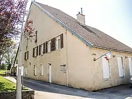 The town hall in Saules | |
 Coat of arms | |
Location of Saules | |
 Saules  Saules | |
| Coordinates: 47°07′27″N 6°11′59″E | |
| Country | France |
| Region | Bourgogne-Franche-Comté |
| Department | Doubs |
| Arrondissement | Besançon |
| Canton | Ornans |
| Government | |
| • Mayor (2020–2026) | Louis Daudey[1] |
| Area 1 | 7.64 km2 (2.95 sq mi) |
| Population | 231 |
| • Density | 30/km2 (78/sq mi) |
| Time zone | UTC+01:00 (CET) |
| • Summer (DST) | UTC+02:00 (CEST) |
| INSEE/Postal code | 25535 /25580 |
| Elevation | 369–607 m (1,211–1,991 ft) |
| 1 French Land Register data, which excludes lakes, ponds, glaciers > 1 km2 (0.386 sq mi or 247 acres) and river estuaries. | |
Geography
Saules lies 6 km (3.7 mi) northeast of Ornans above the valley of the Loue.
Population
| Year | Pop. | ±% |
|---|---|---|
| 1962 | 140 | — |
| 1968 | 155 | +10.7% |
| 1975 | 142 | −8.4% |
| 1982 | 159 | +12.0% |
| 1990 | 177 | +11.3% |
| 1999 | 189 | +6.8% |
| 2008 | 215 | +13.8% |
| 2012 | 226 | +5.1% |
See also
References
- "Répertoire national des élus: les maires". data.gouv.fr, Plateforme ouverte des données publiques françaises (in French). 2 December 2020.
- "Populations légales 2020". The National Institute of Statistics and Economic Studies. 29 December 2022.
External links
Wikimedia Commons has media related to Saules (Doubs).
- Saules on the regional Web site (in French)
This article is issued from Wikipedia. The text is licensed under Creative Commons - Attribution - Sharealike. Additional terms may apply for the media files.