Dung, Doubs
Dung (French pronunciation: [dœ̃]) is a commune in the Doubs department in the Bourgogne-Franche-Comté region in eastern France.[3]
Dung | |
|---|---|
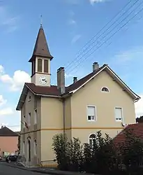 The town hall in Dung | |
 Coat of arms | |
Location of Dung | |
 Dung  Dung | |
| Coordinates: 47°30′19″N 6°45′09″E | |
| Country | France |
| Region | Bourgogne-Franche-Comté |
| Department | Doubs |
| Arrondissement | Montbéliard |
| Canton | Bavans |
| Intercommunality | Pays de Montbéliard Agglomération |
| Government | |
| • Mayor (2020–2026) | Philippe Lacroix[1] |
| Area 1 | 3.22 km2 (1.24 sq mi) |
| Population | 620 |
| • Density | 190/km2 (500/sq mi) |
| Time zone | UTC+01:00 (CET) |
| • Summer (DST) | UTC+02:00 (CEST) |
| INSEE/Postal code | 25207 /25550 |
| Elevation | 320–435 m (1,050–1,427 ft) |
| 1 French Land Register data, which excludes lakes, ponds, glaciers > 1 km2 (0.386 sq mi or 247 acres) and river estuaries. | |
Population
| Year | Pop. | ±% |
|---|---|---|
| 1962 | 466 | — |
| 1968 | 493 | +5.8% |
| 1975 | 519 | +5.3% |
| 1982 | 460 | −11.4% |
| 1990 | 518 | +12.6% |
| 1999 | 579 | +11.8% |
| 2008 | 656 | +13.3% |
| 2012 | 649 | −1.1% |
See also
References
- "Répertoire national des élus: les maires". data.gouv.fr, Plateforme ouverte des données publiques françaises (in French). 9 August 2021.
- "Populations légales 2020". The National Institute of Statistics and Economic Studies. 29 December 2022.
- Commune de Dung (25207), INSEE
Wikimedia Commons has media related to Dung (Doubs).
This article is issued from Wikipedia. The text is licensed under Creative Commons - Attribution - Sharealike. Additional terms may apply for the media files.