Doubs, Doubs
Doubs (French pronunciation: [du] ⓘ) is a commune in the Doubs department in the Bourgogne-Franche-Comté region in eastern France. It lies on the river Doubs, adjacent to the north of Pontarlier.
Doubs | |
|---|---|
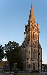 The church in Doubs | |
.svg.png.webp) Coat of arms | |
Location of Doubs | |
 Doubs  Doubs | |
| Coordinates: 46°55′39″N 6°21′03″E | |
| Country | France |
| Region | Bourgogne-Franche-Comté |
| Department | Doubs |
| Arrondissement | Pontarlier |
| Canton | Pontarlier |
| Government | |
| • Mayor (2020–2026) | Georges Côte-Colisson[1] |
| Area 1 | 8.94 km2 (3.45 sq mi) |
| Population | 3,235 |
| • Density | 360/km2 (940/sq mi) |
| Time zone | UTC+01:00 (CET) |
| • Summer (DST) | UTC+02:00 (CEST) |
| INSEE/Postal code | 25204 /25300 |
| Elevation | 795–1,052 m (2,608–3,451 ft) |
| 1 French Land Register data, which excludes lakes, ponds, glaciers > 1 km2 (0.386 sq mi or 247 acres) and river estuaries. | |
Demonym
The inhabitants of Doubs are called Doubsiens[3] or locally Guerrats. This name comes from a local legend which tells that during the Guerre de Dix Ans, the town of Doubs found itself under siege. Trapped for several months without any contact with the outside world, the village quickly became infested with rats. The inhabitants were thus named after them: Guerre + Rats became Guerrats.
Population
| Year | Pop. | ±% p.a. |
|---|---|---|
| 1968 | 789 | — |
| 1975 | 1,049 | +4.15% |
| 1982 | 1,267 | +2.73% |
| 1990 | 1,677 | +3.57% |
| 1999 | 2,266 | +3.40% |
| 2007 | 2,480 | +1.13% |
| 2012 | 2,666 | +1.46% |
| 2017 | 3,021 | +2.53% |
| Source: INSEE[4] | ||
See also
References
- "Répertoire national des élus: les maires" (in French). data.gouv.fr, Plateforme ouverte des données publiques françaises. 13 September 2022.
- "Populations légales 2020". The National Institute of Statistics and Economic Studies. 29 December 2022.
- https://www.habitants.fr/doubs/services-publics
- Population en historique depuis 1968, INSEE
Wikimedia Commons has media related to Doubs (Doubs).
This article is issued from Wikipedia. The text is licensed under Creative Commons - Attribution - Sharealike. Additional terms may apply for the media files.