La Sommette
La Sommette (French pronunciation: [la sɔmɛt]) is a commune in the Doubs department in the Bourgogne-Franche-Comté region in eastern France.
La Sommette | |
|---|---|
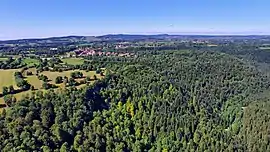 A general view of La Sommette | |
 Coat of arms | |
Location of La Sommette | |
 La Sommette  La Sommette | |
| Coordinates: 47°11′35″N 6°30′41″E | |
| Country | France |
| Region | Bourgogne-Franche-Comté |
| Department | Doubs |
| Arrondissement | Pontarlier |
| Canton | Valdahon |
| Intercommunality | Portes du Haut-Doubs |
| Government | |
| • Mayor (2020–2026) | Serge Gorius[1] |
| Area 1 | 7.37 km2 (2.85 sq mi) |
| Population | 245 |
| • Density | 33/km2 (86/sq mi) |
| Time zone | UTC+01:00 (CET) |
| • Summer (DST) | UTC+02:00 (CEST) |
| INSEE/Postal code | 25550 /25510 |
| Elevation | 525–732 m (1,722–2,402 ft) |
| 1 French Land Register data, which excludes lakes, ponds, glaciers > 1 km2 (0.386 sq mi or 247 acres) and river estuaries. | |
Geography
The commune lies 4 km (2.5 mi) southeast of Pierrefontaine above the gorges of Réverotte.
Population
| Year | Pop. | ±% p.a. |
|---|---|---|
| 1968 | 103 | — |
| 1975 | 104 | +0.14% |
| 1982 | 121 | +2.19% |
| 1990 | 135 | +1.38% |
| 1999 | 129 | −0.50% |
| 2007 | 179 | +4.18% |
| 2012 | 216 | +3.83% |
| 2017 | 236 | +1.79% |
| Source: INSEE[3] | ||
See also
References
- "Répertoire national des élus: les maires" (in French). data.gouv.fr, Plateforme ouverte des données publiques françaises. 13 September 2022.
- "Populations légales 2020". The National Institute of Statistics and Economic Studies. 29 December 2022.
- Population en historique depuis 1968, INSEE
External links
Wikimedia Commons has media related to La Sommette.
- La Sommette on the regional Web site (in French)
This article is issued from Wikipedia. The text is licensed under Creative Commons - Attribution - Sharealike. Additional terms may apply for the media files.