Exincourt
Exincourt (French pronunciation: [ɛɡzɛ̃kuʁ]) is a commune in the Doubs department in the Bourgogne-Franche-Comté region in eastern France.
Exincourt | |
|---|---|
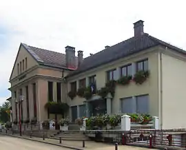 The town hall in Exincourt | |
 Coat of arms | |
Location of Exincourt | |
 Exincourt  Exincourt | |
| Coordinates: 47°29′54″N 6°50′02″E | |
| Country | France |
| Region | Bourgogne-Franche-Comté |
| Department | Doubs |
| Arrondissement | Montbéliard |
| Canton | Bethoncourt |
| Intercommunality | Pays de Montbéliard Agglomération |
| Government | |
| • Mayor (2020–2026) | Magali Duvernois[1] |
| Area 1 | 3.45 km2 (1.33 sq mi) |
| Population | 3,245 |
| • Density | 940/km2 (2,400/sq mi) |
| Time zone | UTC+01:00 (CET) |
| • Summer (DST) | UTC+02:00 (CEST) |
| INSEE/Postal code | 25230 /25400 |
| Elevation | 317–382 m (1,040–1,253 ft) |
| 1 French Land Register data, which excludes lakes, ponds, glaciers > 1 km2 (0.386 sq mi or 247 acres) and river estuaries. | |
Population
| Year | Pop. | ±% p.a. |
|---|---|---|
| 1968 | 4,317 | — |
| 1975 | 4,185 | −0.44% |
| 1982 | 3,776 | −1.46% |
| 1990 | 3,445 | −1.14% |
| 1999 | 3,309 | −0.45% |
| 2007 | 3,230 | −0.30% |
| 2012 | 3,172 | −0.36% |
| 2017 | 3,222 | +0.31% |
| Source: INSEE[3] | ||
See also
References
- "Répertoire national des élus: les maires". data.gouv.fr, Plateforme ouverte des données publiques françaises (in French). 9 August 2021.
- "Populations légales 2020". The National Institute of Statistics and Economic Studies. 29 December 2022.
- Population en historique depuis 1968, INSEE
External links
Wikimedia Commons has media related to Exincourt.
- Official website (in French)
This article is issued from Wikipedia. The text is licensed under Creative Commons - Attribution - Sharealike. Additional terms may apply for the media files.