Sainte-Colombe, Doubs
Sainte-Colombe (French pronunciation: [sɛ̃t kɔlɔ̃b] ⓘ) is a commune in the Doubs department in the Bourgogne-Franche-Comté region in eastern France.
Sainte-Colombe | |
|---|---|
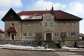 The town hall in Sainte-Colombe | |
Location of Sainte-Colombe | |
 Sainte-Colombe  Sainte-Colombe | |
| Coordinates: 46°52′46″N 6°16′05″E | |
| Country | France |
| Region | Bourgogne-Franche-Comté |
| Department | Doubs |
| Arrondissement | Pontarlier |
| Canton | Pontarlier |
| Government | |
| • Mayor (2020–2026) | Lionel Malfroy[1] |
| Area 1 | 10.49 km2 (4.05 sq mi) |
| Population | 446 |
| • Density | 43/km2 (110/sq mi) |
| Time zone | UTC+01:00 (CET) |
| • Summer (DST) | UTC+02:00 (CEST) |
| INSEE/Postal code | 25515 /25300 |
| Elevation | 809–1,024 m (2,654–3,360 ft) |
| 1 French Land Register data, which excludes lakes, ponds, glaciers > 1 km2 (0.386 sq mi or 247 acres) and river estuaries. | |
Geography
The commune lies 7 km (4.3 mi) northeast of Pontarlier in the valley of the Drugeon.
Population
| Year | Pop. | ±% |
|---|---|---|
| 1962 | 137 | — |
| 1968 | 152 | +10.9% |
| 1975 | 186 | +22.4% |
| 1982 | 224 | +20.4% |
| 1990 | 255 | +13.8% |
| 1999 | 232 | −9.0% |
| 2008 | 279 | +20.3% |
| 2012 | 361 | +29.4% |
Transportation
The commune has a railway station, Sainte-Colombe, on the Frasne–Les Verrières line.
See also
References
- "Répertoire national des élus: les maires" (in French). data.gouv.fr, Plateforme ouverte des données publiques françaises. 13 September 2022.
- "Populations légales 2020". The National Institute of Statistics and Economic Studies. 29 December 2022.
External links
Wikimedia Commons has media related to Sainte-Colombe (Doubs).
- Sainte-Colombe on the regional Web site (in French)
This article is issued from Wikipedia. The text is licensed under Creative Commons - Attribution - Sharealike. Additional terms may apply for the media files.