Levier
Levier (French pronunciation: [ləvje] ⓘ) is a commune in the Doubs department in the Bourgogne-Franche-Comté region in eastern France. On 1 January 2017, the former commune of Labergement-du-Navois was merged into Levier.[3]
Levier | |
|---|---|
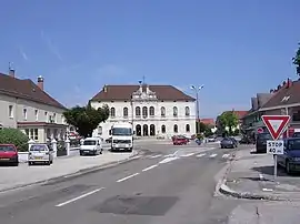 Town center | |
Location of Levier | |
 Levier  Levier | |
| Coordinates: 46°57′15″N 6°07′10″E | |
| Country | France |
| Region | Bourgogne-Franche-Comté |
| Department | Doubs |
| Arrondissement | Pontarlier |
| Canton | Frasne |
| Intercommunality | Altitude 800 |
| Government | |
| • Mayor (2020–2026) | Marc Saulnier[1] |
| Area 1 | 44.34 km2 (17.12 sq mi) |
| Population | 2,269 |
| • Density | 51/km2 (130/sq mi) |
| Time zone | UTC+01:00 (CET) |
| • Summer (DST) | UTC+02:00 (CEST) |
| INSEE/Postal code | 25334 /25270 |
| Elevation | 679–901 m (2,228–2,956 ft) |
| 1 French Land Register data, which excludes lakes, ponds, glaciers > 1 km2 (0.386 sq mi or 247 acres) and river estuaries. | |
Geography
Levier is located 20 km (12 mi) from Pontarlier, 45 km (28 mi) from Besançon, and 14 km (8.7 mi) from the TGV station at Frasne.
Population
| Year | Pop. | ±% p.a. |
|---|---|---|
| 1968 | 1,504 | — |
| 1975 | 1,543 | +0.37% |
| 1982 | 1,710 | +1.48% |
| 1990 | 1,888 | +1.25% |
| 1999 | 1,785 | −0.62% |
| 2007 | 2,016 | +1.53% |
| 2012 | 2,124 | +1.05% |
| 2017 | 2,183 | +0.55% |
| Source: INSEE[4] | ||
Economy
The economy is based on forestry.
See also
References
- "Répertoire national des élus: les maires". data.gouv.fr, Plateforme ouverte des données publiques françaises (in French). 9 August 2021.
- "Populations légales 2020". The National Institute of Statistics and Economic Studies. 29 December 2022.
- Arrêté préfectoral 16 November 2016 (in French)
- Population en historique depuis 1968, INSEE
External links
Wikimedia Commons has media related to Levier (Doubs).
This article is issued from Wikipedia. The text is licensed under Creative Commons - Attribution - Sharealike. Additional terms may apply for the media files.