Saint-Gorgon-Main
Saint-Gorgon-Main (French pronunciation: [sɛ̃ ɡɔʁɡɔ̃ mɛ̃]) is a commune in the Doubs department in the Bourgogne-Franche-Comté region in eastern France.
Saint-Gorgon-Main | |
|---|---|
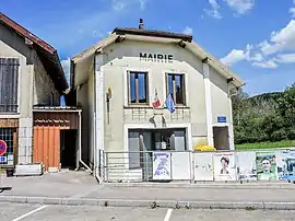 The town hall in Saint-Gorgon-Main | |
Location of Saint-Gorgon-Main | |
 Saint-Gorgon-Main  Saint-Gorgon-Main | |
| Coordinates: 47°01′25″N 6°19′27″E | |
| Country | France |
| Region | Bourgogne-Franche-Comté |
| Department | Doubs |
| Arrondissement | Pontarlier |
| Canton | Ornans |
| Government | |
| • Mayor (2020–2026) | Jean-Luc Felder[1] |
| Area 1 | 7.93 km2 (3.06 sq mi) |
| Population | 276 |
| • Density | 35/km2 (90/sq mi) |
| Time zone | UTC+01:00 (CET) |
| • Summer (DST) | UTC+02:00 (CEST) |
| INSEE/Postal code | 25517 /25520 |
| Elevation | 650–1,050 m (2,130–3,440 ft) (avg. 692 m or 2,270 ft) |
| 1 French Land Register data, which excludes lakes, ponds, glaciers > 1 km2 (0.386 sq mi or 247 acres) and river estuaries. | |
Geography
The commune lies 14 km (8.7 mi) from Pontarlier on the national highway 57 from Besançon to Pontarlier.
Population
| Year | Pop. | ±% p.a. |
|---|---|---|
| 1968 | 146 | — |
| 1975 | 160 | +1.32% |
| 1982 | 163 | +0.27% |
| 1990 | 188 | +1.80% |
| 1999 | 195 | +0.41% |
| 2007 | 251 | +3.21% |
| 2012 | 281 | +2.28% |
| 2017 | 283 | +0.14% |
| Source: INSEE[3] | ||
See also
References
- "Répertoire national des élus: les maires". data.gouv.fr, Plateforme ouverte des données publiques françaises (in French). 2 December 2020.
- "Populations légales 2020". The National Institute of Statistics and Economic Studies. 29 December 2022.
- Population en historique depuis 1968, INSEE
This article is issued from Wikipedia. The text is licensed under Creative Commons - Attribution - Sharealike. Additional terms may apply for the media files.