Saint-Maurice-Colombier
Saint-Maurice-Colombier (French pronunciation: [sɛ̃ moʁis kɔlɔ̃bje]) is a commune in the Doubs department in the Bourgogne-Franche-Comté region in eastern France.
Saint-Maurice-Colombier | |
|---|---|
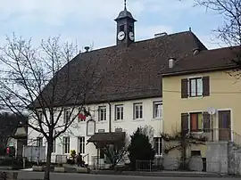 The town hall in Saint-Maurice-Colombier | |
 Coat of arms | |
Location of Saint-Maurice-Colombier | |
 Saint-Maurice-Colombier  Saint-Maurice-Colombier | |
| Coordinates: 47°26′34″N 6°38′43″E | |
| Country | France |
| Region | Bourgogne-Franche-Comté |
| Department | Doubs |
| Arrondissement | Montbéliard |
| Canton | Bavans |
| Intercommunality | Pays de Montbéliard Agglomération |
| Government | |
| • Mayor (2020–2026) | Jacques Demangeon[1] |
| Area 1 | 13.29 km2 (5.13 sq mi) |
| Population | 902 |
| • Density | 68/km2 (180/sq mi) |
| Time zone | UTC+01:00 (CET) |
| • Summer (DST) | UTC+02:00 (CEST) |
| INSEE/Postal code | 25524 /25260 |
| Elevation | 292–491 m (958–1,611 ft) |
| 1 French Land Register data, which excludes lakes, ponds, glaciers > 1 km2 (0.386 sq mi or 247 acres) and river estuaries. | |
Geography
The commune lies 7 km (4.3 mi) north of L'Isle-sur-le-Doubs.
History
The commune was formed by merging the former communes of Saint-Maurice-Échelotte and Colombier-Châtelot in 1972.
Population
| Year | Pop. | ±% |
|---|---|---|
| 1962 | 538 | — |
| 1968 | 568 | +5.6% |
| 1975 | 598 | +5.3% |
| 1982 | 742 | +24.1% |
| 1990 | 729 | −1.8% |
| 1999 | 719 | −1.4% |
| 2008 | 886 | +23.2% |
| 2012 | 897 | +1.2% |
References
- "Répertoire national des élus: les maires". data.gouv.fr, Plateforme ouverte des données publiques françaises (in French). 9 August 2021.
- "Populations légales 2020". The National Institute of Statistics and Economic Studies. 29 December 2022.
External links
Wikimedia Commons has media related to Saint-Maurice-Colombier.
- Saint-Maurice-Colombier on the regional Web site (in French)
This article is issued from Wikipedia. The text is licensed under Creative Commons - Attribution - Sharealike. Additional terms may apply for the media files.